I had been doing a new workout (Cross-Pit) for a few weeks that was really whipping me into some awesome shape. I was feeling like some adventurous exercise to test things out. Flying Mt. Tom has been on my agenda for a while now. Mt. Tom is a site often exclusive to Para-Gliders due to the hike up a 70 to 80% grade on loose shale.
 |
| J-J and I starting up the trail. |
I was up for some rigorous training but 60lbs. of glider and 40-50lbs of gear is a bit beyond my limits without an all day event up such a steep climb. If I was going to fly Mt. Tom, I was going to need another pilot to assist with the hike. I called J-J as he's always up for an adventure. J-J was on board and looking to fly there as well. We both had morning activities in the way so we decided to meet around noon and head out.
 |
| The Summit! |
After rendezvousing at the meeting point, we had both been doing some quick calculations and realized with the allotted time, only one pilot was going to be able to fly. J-J was fine with sitting this one out, and offered to go along and help me out. We embarked and arrived around 3pm at the base of Mt. Tom.
 |
| J-J looking thrilled after the hike. |
We quickly unloaded the car and I put on some cold weather gear for the flight. We hit the trail and made it to the summit in 30 minutes. If I recall, we stopped once or twice to revitalize. The killer wasn't the hike, or the rocky trail, it was the thousands of leaves lining the trail that made for some slippery climbing.
 |
| Launch. Not a fun one! |
We quickly set up my glider and I did a pre-flight. Then we inspected launch and came up with an idea of how to approach it and where J-J was going to be on the wing. The wind was blowing about 15 to 20 mph but everything seemed manageable.
 |
| Times ticking. Not much daylight left. |
As I approached launch, the sculpture of the cliff gave the wind plenty of opportunity to make things difficult. The air was gnarly and J-J had to jump from wing to wing to assist me in keeping the glider on the cliff. In retrospect, I will not launch here again without a 2 or 3 person wire crew. At one point I felt like I was going to be sucked over the edge. As my nerves wound up, my patience grew thin, and the pucker-factor was way beyond 10! I decided the safest thing to do was get into the air by any means necessary.
 |
| Mt. Tom Range, Connecticut River, Skinner State Park in the distance. |
The terrain was too slippery and steep to back off launch with just the two of us. I waited for the glider to stop moving (on the ground), lifted the wing slightly to test the air. I felt the wing stabilize so I pulled in, and ran like a demon from hell, leaving the sun lit red brimstone of the mountain in my dust.
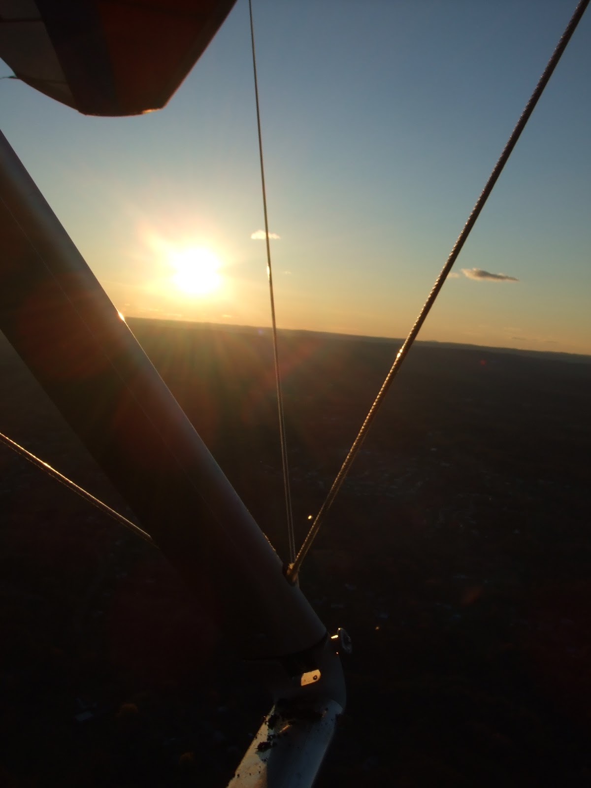
 |
| Full moon on one side. |
Once I was in the air I relaxed and settled in to the screaming lift coming off the ridge. I zipped up so I would stay warm, buzzed launch to thank J-J, and headed North to get some pictures. As I returned to launch, J-J had already left and began the descent. The plan was for him to get the car and meet me at the pre-determined LZ.
 |
| Sunset on the other. |
I began exploring the ridge and realizing I could do a bit more than just stay at Mt. Tom. There were small ratty thermals poking up, and I was able to get 700 fpm up in a few of them. I topped out at 2076' but had plenty of altitude over the 1100' ridge. I began to eye Mt. Holyoke in Skinner State Park to the North, another site I have flown.
 |
| View from aloft. |
 |
| Sunset. |
 |
| Affectionately known as 'The Rock', more appropriately named 'The Radiation!'. |
As I flew the ridge and pondered trying to jump the gap to Skinner, I bounced back and forth between laying out my strategy, and fighting the inner turmoil in my head that was going to send J-J to the wrong LZ waiting for me to land, and then finding no sign of me. Plus I would be on the other side of the river which was not an easy hop skip and a jump (unless you're in the air).
I had left the radio behind as it was added weight. So I had no way of communicating my intentions with J-J. Eventually I decided, flying two sites in one day without touching the ground, and making an attempt at something I had yet to try but chomped at the bit to do, was far more important than a little stress and out of the way driving for my compatriot. Off I went.
 |
| Almost there! A little closer... |
I gained as much altitude as I could, topping out at a little over 2k feet. I setup my course, had my bailouts if I didn't make it, pulled the bar in to best glide, and lunged forth into the unknown. Visor was down, I tucked my arms and elbows, and streamlined my body as tight as I could get it. I stayed ever vigil on bar position the entire way as I had no room to spare - this was going to be tight.
 |
| MADE IT!!! Skinner Launch fly by. |
There was no margin for error if I made a mistake, or got lazy on my glide as there would be no lift in between. The late day and lack of thermal activity meant I that whatever altitude I left with, was all I had in the bag.
 |
| View of LZ after passing by launch. Plenty of ridge lift here too! |
I made it! I came in to the ridge and picked up the lift band climbing back out. I arrived about 200' over launch with a huge ass grin on my face. Followed by a few hoots and hollars. By now I had completely forgotten about my hesitation and inconveniencing my friend. The party was on!
 |
| The Skinner State Park Summit House - Proof of Flight. |
I soared the Holyoke range soaking in the glory and then proceeded to do a few wing overs to celebrate. As I simmered down, I noticed the view settling in over the valley.
 |
| Hard to go land when you have a view like this! |
As dusk quickly approached, I soaked every last minute I could get of the spectacular view then peeled out to make my final approach. I flew down the riverbed and came in to the LZ with a nice no step landing to a few cars that had stopped to see the show.
After snapping a few pics I called J-J and gave him my location for retrieve. He quickly got on course and arrived 25 minutes later to pick me up. Thanks go out to him for his support!
 |
| Breaking down in the dark. |
 |
| Full moon over Mt. Holyoke. |
Total airtime: 35:00 minutes.
Total distance: 5.01 miles